
Loading...
SKU:
NACH1024
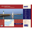
Imray 2110 North France Chart Pack
£59.95
Unit price
/
Unavailable
Tax included
Shipping calculated at checkout.
Imray 2110 North France Chart Pack is backordered and will ship as soon as it is back in stock.
Couldn't load pickup availability
Imray 2110 North France Chart Pack
£59.95
Unit price
/
Unavailable
Imray 2110 North France Chart Pack
Plans:
- 2110.1 Eastern English Channel 1: 600 000 WGS 84
- 2110.2 Dover Strait 1: 200 000 WGS 84
- 2110.3 Cap Gris-Nez to Dieppe 1: 200 000 WGS 84
- 2110.4 Nieuwpoort & Nord-Pas-de-Calais Plans Scales: various WGS 84 Plans included: Nieuwpoort (1:30 000) Rade de Dunkerque (1:125 000) Dunkerque (1:25 000) Calais (1:20 000) Boulogne-sur-Mer (1:25 000) Étaples (1:75 000)
- 2110.5 Dieppe to Le Havre 1: 200 000 WGS 84
- 2110.6 Picardy & Upper Normandy Plans Scales: various WGS 84 Plans included: Baie de Somme (1:75 000) Le Tréport (1:12 500) Dieppe (1:12 500) St-Valéry-en-Caux (1:12 500) Fécamp (1:12 500)
- 2110.7 Approaches to Le Havre & River Seine 1: 60 000 WGS 84
- 2110.8 River Seine Plans Scales: various WGS 84 Plans included: Le Havre (1:12 500) River Seine to Tancarville (1:63 000) Honfleur (1:12 500)
- 2110.9 Baie de Seine (East) 1: 155 000 WGS 84
- 2110.10 Baie de Seine (West) to Cherbourg 1: 155 000 WGS 84
- 2110.11 Lower Normandy Plans Scales: various WGS 84 Plans included: Deauville/Trouville (1:15 000) Dives-sur-Mer (1:30 000) Ouistreham (1:25 000) Courseulles-sur-Mer (1:20 000) Arromanches (1:35 000) Port-en-Bessin (1:10 000) Grandcamp-Maisy (1:6000) Baie du Grand Vey (1:75 000) Saint-Vaast-La-Hougue (1:20 000) Barfleur (1:15 000) Cherbourg (1:40 000) Port Chantereyne (Cherbourg) (1:10 000) Omonville-la-Rogue (1:7000)
