Loading...
SKU:
NACH1045
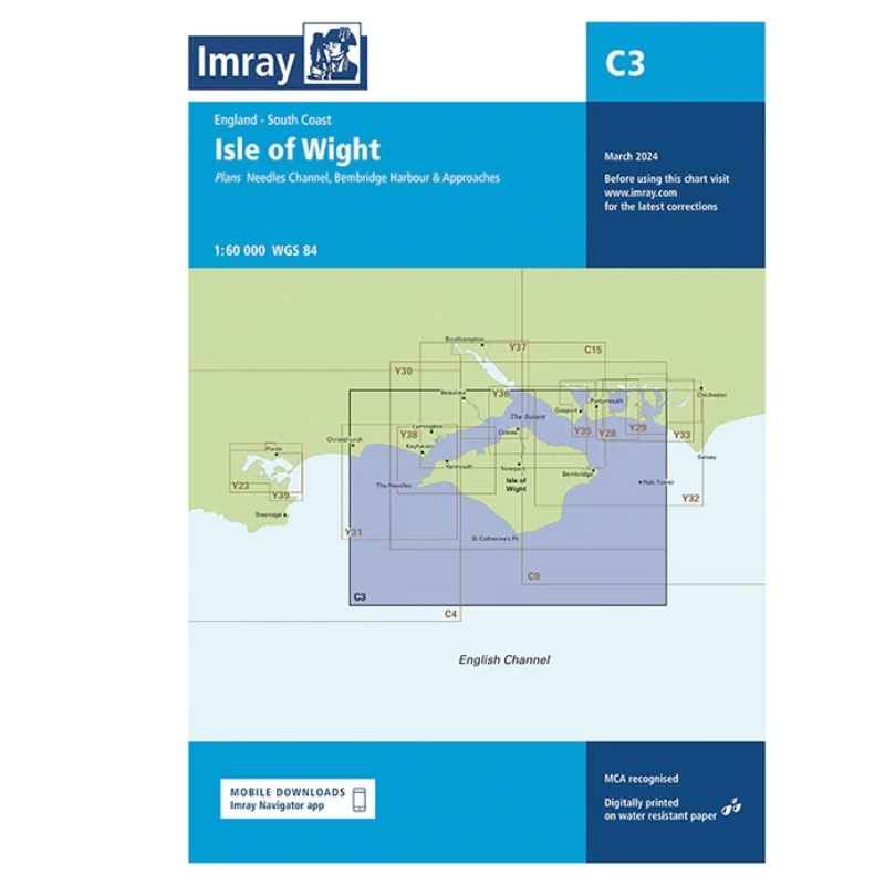
Imray Chart C3 Isle of Wight
£28.95
Unit price
/
Unavailable
Tax included
Shipping calculated at checkout.
Imray Chart C3 Isle of Wight is backordered and will ship as soon as it is back in stock.
Couldn't load pickup availability
Imray Chart C3 Isle of Wight
£28.95
Unit price
/
Unavailable
Imray Chart C3 Isle of Wight
A passage planning chart ideal for sailing near or around the Isle of Wight. This chart has been reschemed to better complement the other folded charts in our Solent chart range (C15, Y33). Coverage has been adjusted to show the full circumnavigation of the Isle of Wight including the south coast passage. Inset plans of the Needles Channel and Bembridge Harbour and approaches are included.
The latest official UKHO data is combined with additional information sourced from Imray's network to make it ideal for small craft.
Plans:
- Lymington River (1:17 500)
- River Hamble (1:20 000)
- Bembridge Harbour (1:20 000)
- Continuation of Southampton Water (1:45 000)
